Tenedos Bay is one of Desolation Sound's most beloved stops — a mountain-ringed fjord where the saltwater runs 75°F+ in July and August, and a ten-minute forest trail delivers you to Unwin Lake's crystalline freshwater for the best back-to-back swim in BC. Busy in summer; worth every boat.
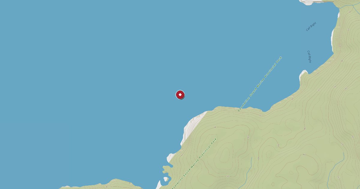
Tenedos Bay cuts deep into the mainland coast of Desolation Sound Marine Provincial Park, its steep forested walls enclosing one of the most rewarding anchorages on the BC coast. The bay lies east of Mink Island along Homfrey Channel, roughly seven miles from Refuge Cove on West Redonda Island — close enough for a morning run to top up fuel or provisions, far enough to feel genuinely remote.nnThe centrepiece facility here is a BC Parks float and stern-tie installation in the bay's northeastern corner, clustered near the stream outflow from Unwin Lake. Fourteen pin-and-chain stern tie rings are distributed along the shoreline, supplemented by a small park float that doubles as the main landing for the Unwin Lake trail. The float is unmaintained for power or services — no fuel, no water hookup, no shore power — but it provides a solid, convenient place to tie a dinghy or snug a smaller vessel bow-to while the crew heads ashore. Larger boats typically anchor in eight to fifteen metres over good holding mud in the shallower coves at the head of the bay or along the eastern shoreline, then run a stern line to one of the park rings.nnThe main event is Unwin Lake. Follow the trail north from the park float through old-growth rainforest — cedar and fir with a mossy understorey — and within ten minutes you emerge at the lake's southern shore. The water temperature in July and August regularly exceeds 24°C (75°F), making Unwin one of the warmest accessible freshwater swims in British Columbia. There is a small dock on the lake itself where boaters have been jumping off for generations, plus rocky ledges for cliff-jumping and long grassy banks for lying in the sun. The trail continues around the western side of the lake if you want to push further into the backcountry.nnAnchorage options vary by boat size and taste. The northwest corner of the bay offers open anchoring in reasonable depths. The extreme northern end, behind the island shelf near the stream, is the most protected spot and the one closest to the park float. Note that the centre of Tenedos Bay drops to 90–180 metres — far too deep to anchor — so concentrate your search for holding ground toward the bay's head and the eastern shoreline coves. A submerged rock off Bold Head guards the entrance on the south side; give it a generous berth on arrival and departure.nnThe Curme Islands, just south of Tenedos Bay, add to the appeal. The emerald-coloured water around the islands is shallow enough to dinghy through and popular with kayakers making their way up from the Okeover or Lund put-ins. Camping pads at Curme East and Curme South are managed by BC Parks.nnFor provisions and fuel, Refuge Cove (West Redonda Island) is the closest full-service stop: diesel, gasoline, propane, water, a small grocery store, and dockside moorage on a first-come basis. Lund, about 20 nautical miles to the south, has a public float, fuel dock, grocery store, and the famous Laughing Oyster and Nancy's Bakery. There is no VHF working channel and cell service is absent inside the bay — download charts and weather before you leave.nnTiming matters. Tenedos Bay is one of the most popular anchorages in the entire Inside Passage circuit. By mid-July the bay routinely holds 30–50 boats on a weekend night, and the park float and stern rings fill by early afternoon. Arrive before noon for your choice of spots, or accept a midfield anchor and dinghy ashore. Shoulder season — late June or early September — offers the same warm water with a fraction of the crowds. BC Parks collects a nightly moorage fee as part of the Desolation Sound Marine Park; rangers patrol by boat and issue receipts. Check current BC Parks fee schedules before departure.
Fuel and shore power available at Tenedos Bay / Unwin Lake Park Dock.
Plus Live prices · no recent update
Laundry, groceries, a patch of grass for the dog, the nearest decent meal — here's what's within reach of Tenedos Bay / Unwin Lake Park Dock. Tap any pin on the map for the details.
Plus members get the full picture — walking times to each stop, member notes, and ratings from cruisers who've actually been ashore here.
Wind protection summary and tide planning at a glance. Full per-direction and 7-day detail with Plus.
Refreshed every 15 minutes from the nearest weather station.
Source: OpenWeather One Call API + WorldTides.
First-hand reports and real questions from members who have tied up at Tenedos Bay / Unwin Lake Park Dock. Switch between reviews and the community Q&A below.
Cruising info goes stale fast — fees change, fuel docks close, hours shift. WalkTheDock stays accurate because boaters who’ve actually been here keep it current. Spot something out of date? Suggest a correction; once a moderator approves it the change goes live and you’re credited below.
No community updates yet — spotted something out of date? Use “Suggest an edit” below.
Please log in to suggest edits.
Log inIf Tenedos Bay / Unwin Lake Park Dock is full or you are weighing options, here is the closest moorage — sorted by distance.
No nearby anchorages found.
No other marinas nearby yet — we are adding more.