The government dock at Port Hardy is northern Vancouver Island's busiest transient hub — the last full-service stop before the Inside Passage opens north toward Prince Rupert. A wharfinger is on duty daily, with fuel nearby, pump-out on-site, and town provisions within easy reach.
Port Hardy sits at the northern tip of Vancouver Island, and its Harbour Authority — sometimes called Fisherman's Wharf — is the pivot point where the sheltered channels of the Inside Passage begin in earnest. For northbound cruisers the stop is often their last chance to top up fuel, fill water tanks, and stock provisions before committing to the wilder coastline toward Bella Bella, Klemtu, and ultimately Prince Rupert. For southbound boats it is often the first real exhale after days of remote running.
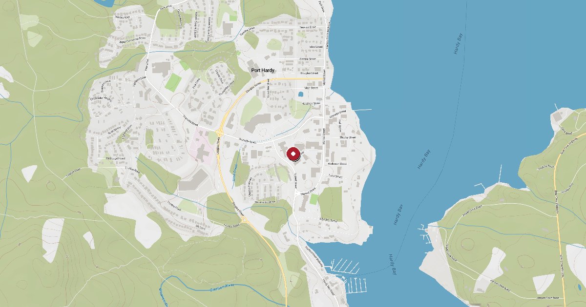
The Harbour Authority occupies Hardy Bay at 6600 Hardy Bay Road and consists of the inner Fisherman's Wharf finger floats plus the seasonal Seagate T-Floats — a set of outer floats off Seagate Pier that open from June through September for pleasure craft up to 60 feet. Both are managed under the Port Hardy Harbour Authority, with a wharfinger on duty seven days a week from 7 am to 6 pm in summer. The Fisherman's Wharf basin is primarily home to the commercial fishing fleet, which means transient space opens up considerably during summer when the fleet is at sea — a pleasant surprise for cruisers arriving mid-season.
A black-water pump-out station sits on the loading zone float at Fisherman's Wharf, a rarity on this stretch of coast. Shore power runs to 30A on finger floats and 50A on the main float. Fresh water is available on all dock fingers. The authority accepts credit and debit cards. A concrete boat launch with a hydraulic dock winch is available on-site.
For fuel, the primary destination is Coastal Mountain Fuels at Bear Cove, ten minutes by road toward the BC Ferries terminal (6720 Bear Cove Hwy, 250-949-9988). Coastal Mountain handles vessels up to 250 feet with marine diesel and midgrade gasoline, plus propane, lubricants, and ice. Quarterdeck Marina at 6555 Hardy Bay Road, a private full-service marina immediately adjacent to town, runs its own fuel dock with diesel and gasoline and offers 134 slips, 50A power, Wi-Fi, and an onsite pub and restaurant.
The BC Ferries terminal — the northern Vancouver Island terminus for Route 10, the Inside Passage sailing to Prince Rupert — is at Bear Cove, not at the harbour docks. The M.V. Northern Expedition covers roughly 274 nautical miles in fifteen to twenty-two hours, with seasonal stops at Bella Bella and Klemtu. Cruising boats do not use the BC Ferries dock; the ferry connection is a town amenity and a useful reference point for crew changes.
Port Hardy town is walkable from the Seagate T-Floats and about a mile from Fisherman's Wharf. Save-On-Foods, the only full grocery in town, will deliver to moorage locations. Restaurants line Market Street. Hardy Buoys Smoked Fish sells vacuum-packed salmon products worth carrying north. A hospital with 24-hour emergency services operates in town — reassuring given that the next comparable medical facility northward is a long passage away.
Navigation note: yellow buoys mark a drying reef south of the Seagate T-Floats — pass east of the reef when entering the inner bay. Tidal range at Port Hardy reaches nineteen feet, so a careful eye on lines and fenders is warranted. The harbour is known for being fog-free when surrounding headlands are socked in, a genuine advantage at the start or end of a long offshore day.
Port Hardy is an official Canadian port of entry for vessels arriving from foreign waters, and the harbour authority can direct visiting boats to the appropriate customs procedures.
Fuel and shore power available at Port Hardy Harbour Authority.
Plus Live prices · no recent update
Laundry, groceries, a patch of grass for the dog, the nearest decent meal — here's what's within reach of Port Hardy Harbour Authority. Tap any pin on the map for the details.
Plus members get the full picture — walking times to each stop, member notes, and ratings from cruisers who've actually been ashore here.
Wind protection summary and tide planning at a glance. Full per-direction and 7-day detail with Plus.
Refreshed every 15 minutes from the nearest weather station.
Source: OpenWeather One Call API + WorldTides.
First-hand reports and real questions from members who have tied up at Port Hardy Harbour Authority. Switch between reviews and the community Q&A below.
Cruising info goes stale fast — fees change, fuel docks close, hours shift. WalkTheDock stays accurate because boaters who’ve actually been here keep it current. Spot something out of date? Suggest a correction; once a moderator approves it the change goes live and you’re credited below.
No community updates yet — spotted something out of date? Use “Suggest an edit” below.
Please log in to suggest edits.
Log inIf Port Hardy Harbour Authority is full or you are weighing options, here is the closest moorage — sorted by distance.
No nearby anchorages found.
No other marinas nearby yet — we are adding more.