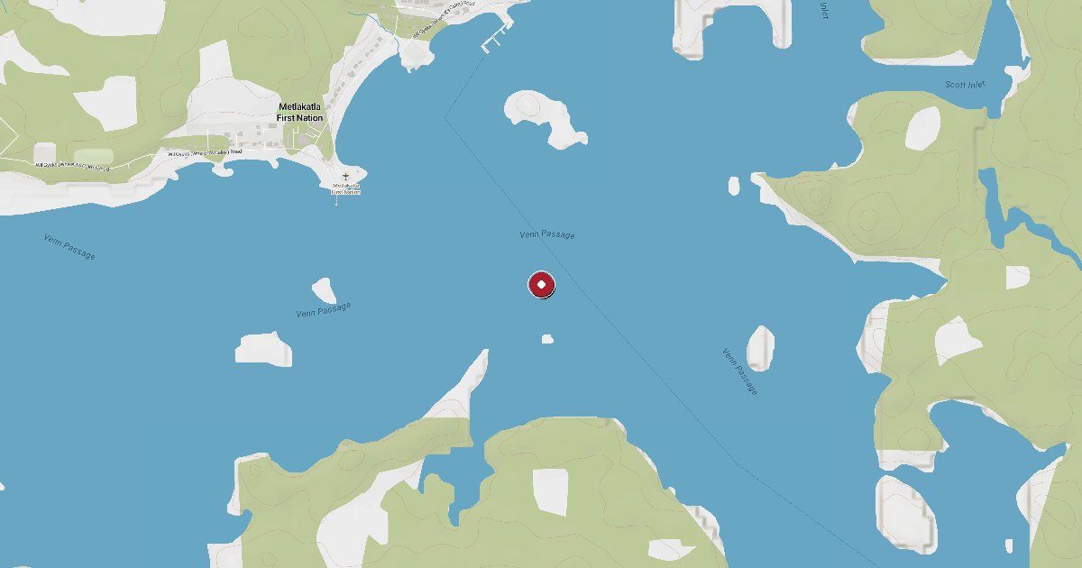
Metlakatla is a small Tsimshian First Nation reserve community on the Tsimshian Peninsula, a 15-minute ferry ride from Prince Rupert through Venn Passage. The community dock serves the Metlakatla Development Corporation ferry and local fishing boats. The reserve is closed to the public without advance permission from the Governing Council.
Metlakatla sits at the entrance to Venn Passage (also called Metlakatla Pass), roughly 5 km northwest of Prince Rupert on the Tsimshian Peninsula. The name means saltwater pass in Sm'algyax, the Coast Tsimshian language, and the passage itself threads between forested headlands to connect Prince Rupert Harbour with open Chatham Sound. Population is approximately 80 to 100 residents year-round.
This is not a recreational marina. The dock at Metlakatla village is a community and ferry landing operated by the Metlakatla Development Corporation (MDC), the economic arm of the Metlakatla First Nation. The MDC runs daily weekday ferry service to and from Prince Rupert — departing from Cow Bay, below the Museum of Northern BC (phone 250-624-3337) — with the crossing taking roughly 15 minutes. The North Co Corp vessel Tsimshian Storm, jointly owned by Metlakatla, Hartley Bay, and Kitkatla First Nations, runs a twice-weekly regional route connecting Prince Rupert to Oona River, Kitkatla, and Hartley Bay.
Metlakatla reserve is closed to unsolicited visitors. Anyone wishing to enter the community — including boaters considering tying up — must obtain advance permission from the Metlakatla Governing Council (250-628-3234). No transient moorage slips, guest berths, fuel, shore power, or visitor amenities have been documented at the community dock. There is no restaurant, store, or place to purchase supplies in the village.
The one public exception is the Metlakatla Wilderness Trail, a renowned day-hike along a heritage route originally built by the Tsimshian in the 1800s and restored by the community. The Governing Council runs a free twice-weekly charter ferry (Tuesdays and Saturdays, limited to 20 hikers, sign-in required) for trail visitors during the May through October season. Hikers are strongly advised to bring all food, water, and gear — nothing is available for purchase at the village end.
For cruising boaters, Metlakatla Pass and Venn Passage are familiar waypoints on the north coast route between Prince Rupert and Chatham Sound. The passage provides a sheltered inside channel, and the community dock is a reference point on charts, but it is not a stop for services. Prince Rupert — 15 minutes south by fast ferry — is where fuel, provisions, moorage, and repairs are available.
Wind exposure at the dock is moderate. The village is tucked into the western shore of the Tsimshian Peninsula with partial protection from surrounding terrain, but Venn Passage itself channels winds, and open Chatham Sound immediately to the west is subject to significant NW and SE weather systems rolling in from Hecate Strait. Boaters transiting Venn Passage should consult current conditions before rounding into Chatham Sound.
Fuel and shore power available at Metlakatla Ferry Dock.
Plus Live prices · no recent update
Laundry, groceries, a patch of grass for the dog, the nearest decent meal — here's what's within reach of Metlakatla Ferry Dock. Tap any pin on the map for the details.
Plus members get the full picture — walking times to each stop, member notes, and ratings from cruisers who've actually been ashore here.
Wind protection summary and tide planning at a glance. Full per-direction and 7-day detail with Plus.
Refreshed every 15 minutes from the nearest weather station.
Source: OpenWeather One Call API + WorldTides.
First-hand reports and real questions from members who have tied up at Metlakatla Ferry Dock. Switch between reviews and the community Q&A below.
Cruising info goes stale fast — fees change, fuel docks close, hours shift. WalkTheDock stays accurate because boaters who’ve actually been here keep it current. Spot something out of date? Suggest a correction; once a moderator approves it the change goes live and you’re credited below.
No community updates yet — spotted something out of date? Use “Suggest an edit” below.
Please log in to suggest edits.
Log inIf Metlakatla Ferry Dock is full or you are weighing options, here is the closest moorage — sorted by distance.
No nearby anchorages found.
No other marinas nearby yet — we are adding more.