Big Bay's rebuilt community dock is the key staging point for boats transiting the Yuculta and Dent Rapids complex — drop anchor here after riding the Yucultas, rest up, then tackle Gillard and Dent on the next slack. The government wharf accommodates vessels to 100 ft, with a store, post office, laundry, showers, and free Wi-Fi run by the Stuart Island Community Association.
Big Bay sits at the eastern end of Cordero Channel where it meets Calm Channel, on the northwest shore of Stuart Island. The Stuart Island Community Association Dock has been substantially rebuilt and expanded, now taking vessels over 100 feet on open floats. Expect a working, laid-back waterfront atmosphere — this is a functional stop, not a resort marina. The store stocks convenience items, ice, and liquor; a covered pavilion deck with tables and chairs is great for an evening recap. A post office serves the tiny island community. Staff are on-call 24 hours in season.
Note that the once-famous Big Bay pub and fuel dock are no longer operating as public facilities. The bay bottom is largely rocky and not good holding; most cruisers tie to the dock rather than anchor. A significant shoal lies just off the dock — approach from the south, keeping a careful eye on depth. The current from Yuculta Rapids can run into the bay, so expect some swirl depending on the tide stage.
For northbound passage-makers, the standard play is to transit the Yuculta Rapids near slack water, then overnight at Big Bay's dock. The following day, time the Gillard Passage and Dent Rapids slack (keyed off Gillard — Dent goes slack roughly 15 minutes before Gillard, Yucultas flood about 25 minutes after). Dent Island Lodge lies just 2.1 NM to the west if you want a pricier alternative. Southbound boats on a flooding tide can favour the Stuart Island shore eddy up to Kellsey Point, crossing to the Sonora Island side once conditions allow.
Cordero Channel in this area is subject to strong katabatic outflow winds funnelling out of Bute Inlet to the east — these blow from the NW/WNW and can arrive with little warning, particularly in winter and spring. The bay is partially shielded from westerly swell by the Stuart and Sonora Island landmass, but the NW exposure is real. Southeast storms have a long fetch along the channel. The overall anchorage is best characterised as a fair-weather stop or a calm-night dock — not a secure hole-up in a blow.
Fuel and shore power available at Big Bay Government Dock.
Plus Live prices · no recent update
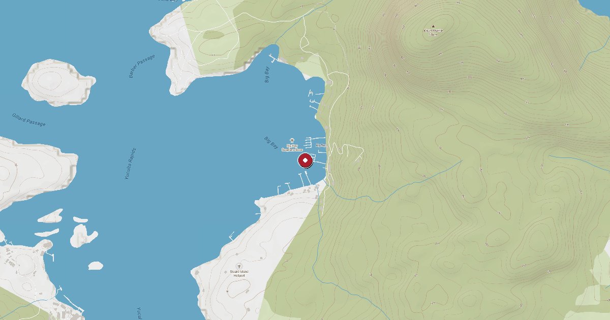
Laundry, groceries, a patch of grass for the dog, the nearest decent meal — here's what's within reach of Big Bay Government Dock. Tap any pin on the map for the details.
Plus members get the full picture — walking times to each stop, member notes, and ratings from cruisers who've actually been ashore here.
Wind protection summary and tide planning at a glance. Full per-direction and 7-day detail with Plus.
Refreshed every 15 minutes from the nearest weather station.
Source: OpenWeather One Call API + WorldTides.
First-hand reports and real questions from members who have tied up at Big Bay Government Dock. Switch between reviews and the community Q&A below.
Cruising info goes stale fast — fees change, fuel docks close, hours shift. WalkTheDock stays accurate because boaters who’ve actually been here keep it current. Spot something out of date? Suggest a correction; once a moderator approves it the change goes live and you’re credited below.
No community updates yet — spotted something out of date? Use “Suggest an edit” below.
Please log in to suggest edits.
Log inIf Big Bay Government Dock is full or you are weighing options, here is the closest moorage — sorted by distance.
No nearby anchorages found.
No other marinas nearby yet — we are adding more.