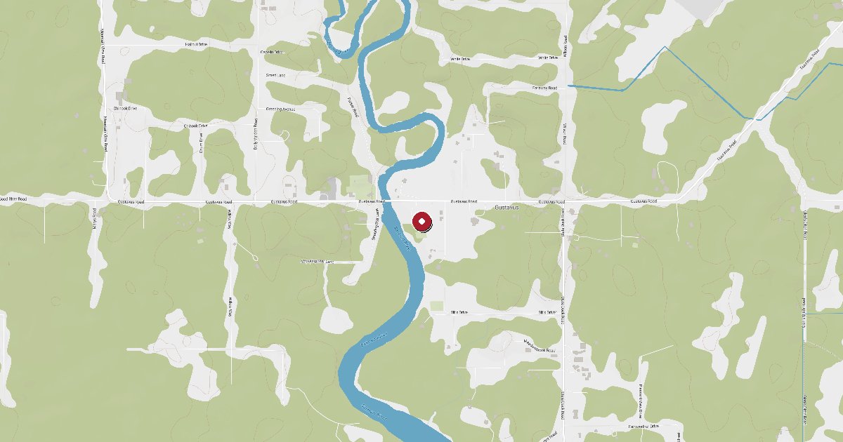
Gustavus is the gateway to Glacier Bay National Park on the north shore of Icy Strait, about 62 nm northwest of Juneau. The state dock and Salmon River small boat harbor offer transient moorage, and Gustavus Dray provides marine gasoline and diesel right at the dock — the only fuel stop before pushing into Glacier Bay proper.
Gustavus sits at the mouth of the Salmon River where it meets Icy Strait, accessible only by boat or plane, and serves as the primary land-side gateway to Glacier Bay National Park. The community is small, about 400 year-round residents, but its position makes it a key waypoint for cruising boats working the northern Inside Passage and the waters between Juneau and Yakutat.
The Gustavus Dock is a state-maintained facility located on State Dock Road, about two miles from town center. Gustavus Dray, Inc. operates marine fuel services at the western end of the dock in a clearly marked blue-shaded fueling zone. Both gasoline and diesel are available. Summer hours run May through September, 5 AM to 9 AM Monday through Saturday; outside summer the operation shifts to on-call 24/7. Phone 907-697-2481 to arrange a delivery. A 24-hour automated pump accepting Visa and Mastercard is also available for after-hours needs. Gustavus Dray recommends fueling in the morning: afternoon westerlies can build quickly across Icy Strait and make dock work uncomfortable at the exposed western end.
In addition to the state dock, the Salmon River Boat Harbor provides small-craft moorage slightly to the west. The harbor is tidal and drains significantly at low water, and is primarily used by local fishing and recreational boats. The City of Gustavus employs a Marine Facilities Coordinator who monitors both the dock and the Salmon River harbor six days a week through the summer season. Annual registration is available for local vessels; transient boaters pay daily fees. Contact [email protected] for current rates and slip availability.
The dock is exposed to westerly weather. Icy Strait funnels wind from the open Pacific, and swell can make the outer dock rolly in afternoon conditions. Tides and currents are significant at the dock face; plan your approach and departure accordingly. Glacier Bay National Park requires advance permits for recreational vessels entering the park between June 1 and August 31, and Bartlett Cove (10 miles by road from Gustavus) serves as the park check-in point. Many boaters use the Gustavus Dock as a fuel and supplies stop before or after their Glacier Bay transit.
Town services including groceries, lodging, and the airport are about two miles from the dock via State Dock Road. A NOAA weather buoy (GUXA2) is stationed at the dock and transmits real-time wind, water temperature, and wave data useful for planning your departure timing on Icy Strait.
Fuel and shore power available at Gustavus Dock / Boat Harbor.
Plus Live prices · no recent update
Laundry, groceries, a patch of grass for the dog, the nearest decent meal — here's what's within reach of Gustavus Dock / Boat Harbor. Tap any pin on the map for the details.
Plus members get the full picture — walking times to each stop, member notes, and ratings from cruisers who've actually been ashore here.
Wind protection summary and tide planning at a glance. Full per-direction and 7-day detail with Plus.
Refreshed every 15 minutes from the nearest weather station.
Source: OpenWeather One Call API + WorldTides.
First-hand reports and real questions from members who have tied up at Gustavus Dock / Boat Harbor. Switch between reviews and the community Q&A below.
Cruising info goes stale fast — fees change, fuel docks close, hours shift. WalkTheDock stays accurate because boaters who’ve actually been here keep it current. Spot something out of date? Suggest a correction; once a moderator approves it the change goes live and you’re credited below.
No community updates yet — spotted something out of date? Use “Suggest an edit” below.
Please log in to suggest edits.
Log inIf Gustavus Dock / Boat Harbor is full or you are weighing options, here is the closest moorage — sorted by distance.
No nearby anchorages found.
No other marinas nearby yet — we are adding more.