The Gitgaʼat First Nation’s community dock on Douglas Channel—a key waypoint on the Inside Passage. Free alongside moorage, fuel (gas and diesel), and shore power make this remote village stop a welcome find. Best known as the jumping-off point for Spirit Bear eco-tours to Gribbell Island.
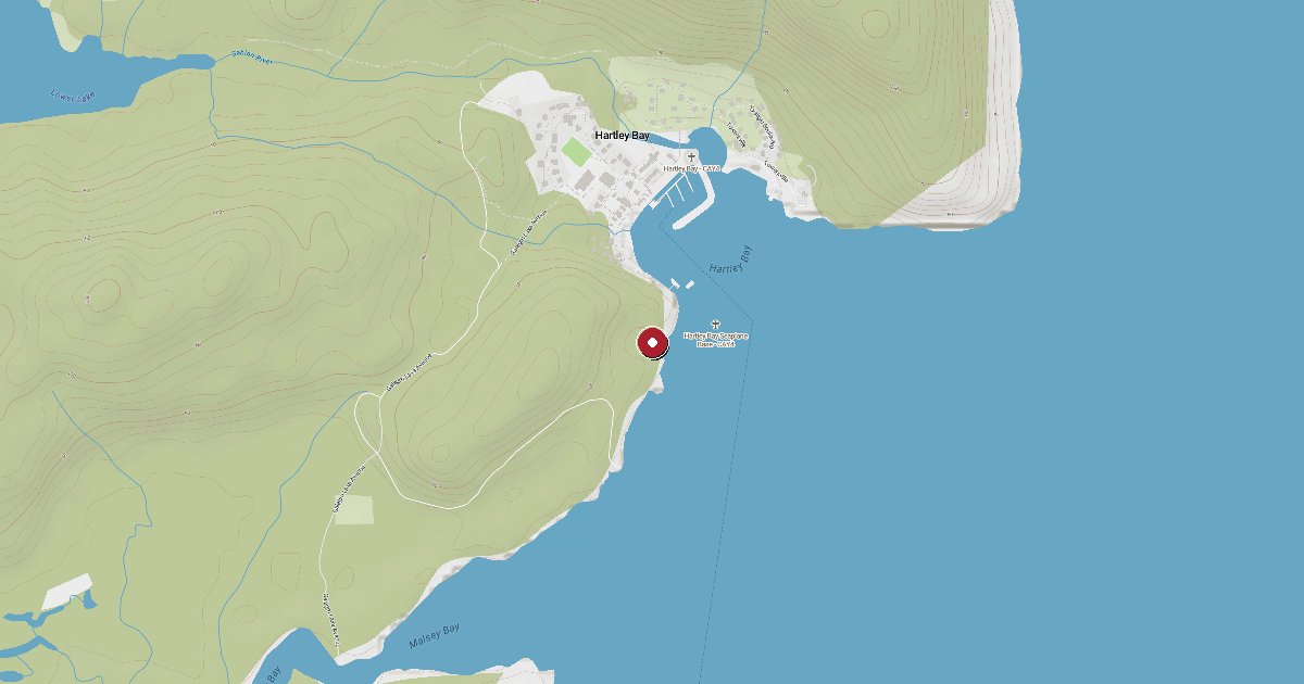
Hartley Bay sits at the mouth of Douglas Channel, about 145 km south of Prince Rupert, accessible only by boat or floatplane. The dock is owned and operated by the Gitga'at Nation through Gitga'at Development Co., and it functions simultaneously as a community wharf, a fuel station for commercial fishing vessels, and a transient stop for cruisers making the passage to Alaska or returning south.
The Gitga'at people have fished and inhabited this part of the Douglas Channel coast for thousands of years. Most travellers who stop here know them from a single dramatic event: in March 2006, the BC Ferries vessel Queen of the North struck Gil Island in Wright Sound and sank. It was Gitga'at fishermen and community members who launched their boats in the dark, in cold water, and pulled 99 survivors to safety. Two passengers were lost. The village's response was internationally recognized as an act of extraordinary community courage.
Today Hartley Bay is also the primary base for guided Spirit Bear eco-tours. Gribbell Island, a short boat ride up the channel, is one of the only places on earth where the Kermode bear—a rare white-coated subspecies of the black bear, sacred to coastal First Nations—can be reliably observed in the wild. Several Gitga'at-run guiding operations work out of Hartley Bay, particularly in late summer and fall when bears congregate at salmon streams.
The dock typically has space for around 40 boats, though the floats can be busy with commercial fishing and gear storage. Transient cruisers report being directed to available space by locals—there is no formal office. Moorage is by donation (effectively free; cruisers who asked directly were told so). Shore power is available and is included in the same goodwill arrangement. Fresh water is on the dock.
Fuel is available in both gasoline and diesel. Summer hours in recent seasons ran weekdays 7 am–12 pm and 1–5 pm with an evening window, and weekends 8 am–12 pm—but fuel availability can be tight in peak season. Call ahead if fuel is your primary reason for stopping; the station occasionally runs short during busy periods.
Navigation note: enter from the southeast of the breakwater; avoid the shallow water southeast of the fuel dock, which is less than 2 m at mean low water. The Canadian Coast Guard maintains a SAR station here with its own float. When the main dock is full, Coghlan Anchorage—behind Promise Island via Stewart Narrows (53°23.9'N 129°17.0'W)—provides a solid backup with mooring buoys.
Douglas Channel runs NW–SE, and the wind patterns follow the classic BC fjord cycle: morning outflow from the northeast draining cold mountain air seaward, and afternoon inflow from the southwest as maritime air pushes inland. Conditions at the dock itself are generally reasonable, but the channel beyond can build steep chop in strong outflow events, particularly autumn through spring.
Fuel and shore power available at Hartley Bay Dock.
Plus Live prices · no recent update
Laundry, groceries, a patch of grass for the dog, the nearest decent meal — here's what's within reach of Hartley Bay Dock. Tap any pin on the map for the details.
Plus members get the full picture — walking times to each stop, member notes, and ratings from cruisers who've actually been ashore here.
Wind protection summary and tide planning at a glance. Full per-direction and 7-day detail with Plus.
Refreshed every 15 minutes from the nearest weather station.
Source: OpenWeather One Call API + WorldTides.
First-hand reports and real questions from members who have tied up at Hartley Bay Dock. Switch between reviews and the community Q&A below.
Cruising info goes stale fast — fees change, fuel docks close, hours shift. WalkTheDock stays accurate because boaters who’ve actually been here keep it current. Spot something out of date? Suggest a correction; once a moderator approves it the change goes live and you’re credited below.
No community updates yet — spotted something out of date? Use “Suggest an edit” below.
Please log in to suggest edits.
Log inIf Hartley Bay Dock is full or you are weighing options, here is the closest moorage — sorted by distance.
No nearby anchorages found.
No other marinas nearby yet — we are adding more.