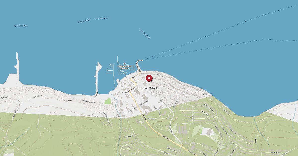
Port McNeill Harbour Authority anchors the gateway town to northern Vancouver Island and the Broughton Archipelago. Northern resident orca gather in numbers around Robson Bight just 25 miles east, and a 45-minute BC Ferries crossing reaches the 'Namgis First Nation's U'Mista Cultural Centre on Cormorant Island.
Port McNeill is reached via Broughton Strait, which runs roughly east-west between Vancouver Island to the south and Malcolm Island to the north. Boats coming up Johnstone Strait from the south typically round the Pearse Islands and enter Broughton Strait. Be aware of the afternoon northwesterly that funnels through both straits with real authority in summer - the wind can build short, steep chop quickly when it opposes an ebb current. Timing departures for the early morning, before the thermal sea breeze fills in from Queen Charlotte Strait, is standard practice. The harbour entrance is well-marked; call the marina on VHF 66A when closing to within a mile or so for slip assignment. The G dock extension reaches beyond the main breakwater and is more exposed; ask for an inner berth if conditions are sloppy.
Port McNeill Harbour Authority operates both the municipal marina and the federal small-craft harbour on Beach Drive, together accommodating a wide range of vessel sizes. Moorage is first-come, first-served with no advance reservations; transient guest moorage is available year-round. Shore power runs to 30A 120V, 50A 240V, and 100A 240V, with fresh water at the dock. The harbour has pump-out, waste oil disposal, and garbage drop. Showers are located above the BC Ferries landing. The harbour office is in the Visitor Centre building above the marina. There is no fuel dock at the Harbour Authority; for diesel and gasoline, proceed to North Island Marina at 1488 Beach Drive (VHF 66A, fuel dock with in-berth fueling available for larger vessels).
Port McNeill punches above its weight for a small northern town. An IGA supermarket, hardware and general merchandise stores, a liquor store, restaurants, and a laundromat are all reachable on foot from the dock. Marine supplies and chandlery are available locally, making this an efficient provisioning stop before pushing north toward Port Hardy or east into the Broughtons. The BC Ferries terminal is at the east end of the waterfront, so crew changes from Vancouver or Campbell River are logistically simple.
BC Ferries runs six sailings a day between Port McNeill and Alert Bay (Cormorant Island), with the crossing taking roughly 45 minutes. The 'Namgis First Nation has occupied Yalis (the Kwakwaka'wakw name for the island) for generations, and the U'Mista Cultural Centre is internationally recognized for its repatriated potlatch collection. The Big House and a totem pole park at the north end of the island are within easy cycling or walking distance of the boat harbour. Sointula on Malcolm Island, a former Finnish utopian settlement with a fishing-village character, is also on the same ferry route.
Johnstone Strait is justifiably famous for its northern resident killer whales. The prime window runs from mid-July through mid-September, when salmon runs draw the whales into the strait in numbers that routinely exceed fifty animals. Robson Bight Michael Bigg Ecological Reserve, about 25 nautical miles east of Port McNeill, is a no-entry marine protected area where the whales rub on the pebble beaches - a behaviour unique to this population. Blackfish Sound to the northwest is a secondary concentration area on the route toward the Broughtons.
Summer weather in Port McNeill is dominated by the northwest-southeast wind axis of Johnstone and Broughton Straits. Morning calms often give way to 15-25 knot northwesterlies by early afternoon as the sea breeze fills in from Queen Charlotte Strait; these typically lay down again by evening. Fog is common in August and early September, particularly in the early morning. October through April brings southeast gales with heavy rain; most transient traffic concentrates in June through September.
Fuel and shore power available at Port McNeill Harbour Authority.
Plus Live prices · no recent update
Laundry, groceries, a patch of grass for the dog, the nearest decent meal — here's what's within reach of Port McNeill Harbour Authority. Tap any pin on the map for the details.
Plus members get the full picture — walking times to each stop, member notes, and ratings from cruisers who've actually been ashore here.
Wind protection summary and tide planning at a glance. Full per-direction and 7-day detail with Plus.
Refreshed every 15 minutes from the nearest weather station.
Source: OpenWeather One Call API + WorldTides.
First-hand reports and real questions from members who have tied up at Port McNeill Harbour Authority. Switch between reviews and the community Q&A below.
Cruising info goes stale fast — fees change, fuel docks close, hours shift. WalkTheDock stays accurate because boaters who’ve actually been here keep it current. Spot something out of date? Suggest a correction; once a moderator approves it the change goes live and you’re credited below.
No community updates yet — spotted something out of date? Use “Suggest an edit” below.
Please log in to suggest edits.
Log inIf Port McNeill Harbour Authority is full or you are weighing options, here is the closest moorage — sorted by distance.
No nearby anchorages found.
No other marinas nearby yet — we are adding more.