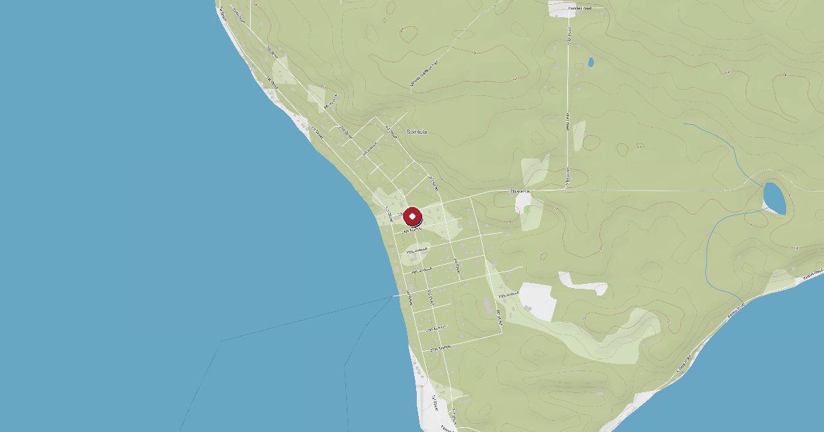
Sointula — place of harmony in Finnish — sits behind a rock breakwater at Rough Bay on Malcolm Island. Founded by utopian Finnish settlers in 1901, it remains a working fishing village with a co-op store, free bike rentals, whale watching, and 3,000 feet of side-tie moorage with power and water.
Few stops on BC's Inside Passage carry as much character per square kilometre as Sointula, the quiet fishing village on Malcolm Island's southern shore. The name means 'place of harmony' in Finnish, and it was chosen with conviction: in 1901, a group of Finnish miners, fed up with grinding work in Robert Dunsmuir's Vancouver Island coal pits, rowed north and established an idealistic socialist colony called the Kalevan Kansa on this uninhabited island. They wrote to visionary journalist and philosopher Matti Kurikka in Finland, who crossed the ocean to lead them. The colony drew several hundred settlers determined to build a society rooted in equality, cooperation, and collective ownership.
The Kalevan Kansa lasted just four years. A catastrophic fire in 1903 killed eleven people in the community hall, gutting both the physical infrastructure and collective morale. Financial mismanagement, clashing philosophies, and Kurikka's polarizing personality fractured the community. The colony dissolved in 1905. But most of the settlers stayed. The fishing was good. In 1909, the remaining settlers opened the Sointula Co-operative Store — still operating today as the oldest continuously running co-op in Western Canada. The Finnish gift for community organization found a new vessel in unions, cooperatives, and mutual aid societies that shaped labour organizing all along the BC coast.
Today Sointula is home to roughly 700-800 people and operates as a working fishing village that wears its heritage without pretence. The Sointula Museum, housed in a former schoolhouse, preserves photos of the Kalevan Kansa, fishing gear, marine engines, and the 1948 gillnetter Sturgeon I displayed outside. The Co-op store still anchors the village. The Upper Crust Bakery turns out Finnish pulla. People still offer strangers a ride along the road.
For arriving boaters, the harbour sits at the head of Rough Bay behind a solid rock breakwater, about one mile north of the BC Ferries terminal. The north and south docks together offer roughly 3,000 linear feet of side-tie moorage, first-come, first-served, rafting encouraged. Power (15A, 20A, and 30A) and potable water are available at both sections. The north dock holds the harbour office, washrooms, showers, and laundry; solar panels on the Lions Club-built building provide the hot water. Fuel is available via co-op truck delivery — call the harbour office at 250-973-6544 to arrange.
Once tied up, free bikes are available at the Sointula Resource Centre, 250 metres from the ferry dock. Malcolm Island rewards cycling: the 24-kilometre island is only 3 kilometres wide at its narrowest. The Kaleva Road Walkway is a flat, 3-kilometre interpretive trail along the waterfront with wildlife viewing platforms. The 5-kilometre Beautiful Bay Trail pushes through old-growth forest to Malcolm Point. Bere Point, at the island's northwest tip, is famous as a killer whale rubbing beach — Northern Resident orcas come in close to scrub their sides on smooth pebbles, one of the more remarkable wildlife encounters available to any boater on the BC coast.
Malcolm Island is accessible by BC Ferries from Port McNeill (25 minutes, multiple daily sailings) and from Alert Bay on Cormorant Island. The dominant weather pattern in the strait is northwest wind — Queen Charlotte Strait and Cormorant Channel are efficient wind tunnels. The breakwater at Rough Bay provides good shelter from the prevailing NW flow; southeast winds are the primary concern in unsettled weather.
Fuel and shore power available at Sointula Harbour Authority.
Plus Live prices · no recent update
Laundry, groceries, a patch of grass for the dog, the nearest decent meal — here's what's within reach of Sointula Harbour Authority. Tap any pin on the map for the details.
Plus members get the full picture — walking times to each stop, member notes, and ratings from cruisers who've actually been ashore here.
Wind protection summary and tide planning at a glance. Full per-direction and 7-day detail with Plus.
Refreshed every 15 minutes from the nearest weather station.
Source: OpenWeather One Call API + WorldTides.
First-hand reports and real questions from members who have tied up at Sointula Harbour Authority. Switch between reviews and the community Q&A below.
Cruising info goes stale fast — fees change, fuel docks close, hours shift. WalkTheDock stays accurate because boaters who’ve actually been here keep it current. Spot something out of date? Suggest a correction; once a moderator approves it the change goes live and you’re credited below.
No community updates yet — spotted something out of date? Use “Suggest an edit” below.
Please log in to suggest edits.
Log inIf Sointula Harbour Authority is full or you are weighing options, here is the closest moorage — sorted by distance.
No nearby anchorages found.
No other marinas nearby yet — we are adding more.